 |
We've passed a lot of fields with cattle and sheep grazing, but not as many with crops growing. Today we saw barley as well as a number of Queens potato stands along the side of the road.
Scott struck up a conversation with a local farmer who came in for gas in his tractor when we were gassing up. He said they have two barley planting seasons. The largest fields in the area were 100 acres, which Scott said was the smallest size that you'll see in Kansas.
When it receded, the land was largest forested, but further climate change let to the forests dying and the emergence of the peat bogs. On the top layer grows a rich variety of life, particularly several different mosses. Spagham moss can retain 20% of its weight in water and has a variety of curative properties, including as an antiseptic. During WWI, it was cut, packaged, and shipped to the front to use on wounds.
There are some places where the forests are purposely being cultivated again. This is controvertial because they dry up the bogs by using more water to grow.
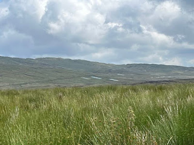
Families that are local have 'peat banks' that are their family right to harvest from. I asked about record keeping and how people know which plot is theirs. There are no markers out in the hills. She said she was unaware of any recording of whose is whose, but that non-locals had to rights to the peat, just locals. Hers is a family plot that has been handed down. It was startling to see how widely the bogs were harvested across the hills. Looking in the distance you can see grey squares where peat has been harvested, as well as the fields closer to where we were walking.
We hiked a road that is used by locals to harvest peat for their own use (its illegal to harvest it commercially). Our guide talked about how it was very much a part of cultural life in the summer. She remembered going up into the hills with her family and helping cut out strips of peat and stack them to dry before loading them to bring them home. It was a day outing with the kids goofing around while the parents worked. Families use them to supplement other heat sources in the winter. They use coal (mostly shipped from Poland these days) and fuel oil. They don't have the infrastructure for natural gas.
At one time locals would bring up beach pebbles to pave the access roads, but the national government passed a law against taking things from the beaches.
When the peat is cut into brick-like logs, its piled like a teepee to dry.
These are whole lines of drying stacks.
Some go up regularly and take out a lot, others (like her) haven't taken any out for years. For many years this work was done by hand which limited the amount being taken out. First they peal off the moss layer on top of the peat, then they cut a strip about 4-6 inches deep and wide and pull out brick-sized chunks of peat. Then they stand this is a teepee shape and occasionally turn the bricks so they get evenly tried. Today, some people hire commercial harvesters to use machinery to take out a lot more from their plots. The gaps are much deeper and the equipment is pretty destructive. It takes 1000 years for peat to generate 1 meter of depth, so its not exactly a renewable resource. The moss will grow over the top again fairly quickly, but the peat that is removed does not really regenerate. There are places where several meters of peat have been removed and you can see the bedrock that is exposed.
A giant storage shed full of peat for the winter.
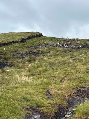
The edge of a bank that has been cut away. Moss grows on the top and recovers it fairly quickly.
Harvesting and burning peat is increasingly problematic for climate change, but our guide said many locals have done it for so long, they don't give a lot of thought to these consequences. The bogs are carbon sinks. When harvested, they release carbon dioxide, and when burned, they release more (and also don't absorb more carbon when they are destroyed). So its a triple environmental whammy.
You can see the remaining elevated island of peat that has been cut on both sides to the depth of several meters. It gives you an idea of how much matter is being removed over time.
Sharon told us about the preservative nature of the bogs. They are quite acidic and things that are under the peat are kept away from the oxygen as well. Bodies that are put in the bog can be found thousands of years later with the skin still on them (basically turned into leather). At one time, locals would bury large cubes of butter (wrapped in linen) in the bog because it worked as a pretty good refrigerator too. The cuts are made vertical with the downward slope of the hill to aid in draining water.
This peat bank has been harvested by heavy machinery. You can see how destructive the technique is.
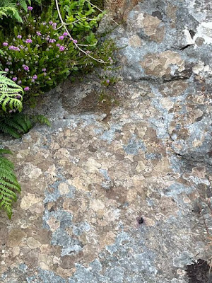
This bank has been harvested down to the bedrock. You can see the dark ridge that shows an older elevation and below that is a grassy field with rocks. These are the quartz stones in the bedrock.
This is an original tree stump from when the bog was mostly forest land. These are regularly uncovered as people harvest the peat. It looks like it was chopped down with a hand ax. Its probably 2000 years old. Its not fossilized, just old and not decayed.
Many different flowers also grow across the bog, most are very small. Many also have some curative properties. These have been passed down from mother to daughter for generations. I was surprised to learn about the bog cotton, which has a single puff of whiteness. It can be used to make thread, or to stuff a pillow, but it takes a while to collect since its so small. Apparently it is a sign of ill health for the bog. It mostly grows in places that have been degraded. She said that over 30% of Ireland used to be bog land, but that is now down to 5% with only 1% deemed healthy. The bog lands are under threat from harvesting of peat (and draining the bog lands), reclamation of land by farmers for agriculture, and by forestation (where the trees use much of the water stored in the peat, which dries the bogs out).
Our guide Sharon was very knowledgable and loved looking at the smallest plants that grow in the bog.
This is reindeer moss. Not only does it look like antlers, it is also a very popular food source for rein deer in Norway (where it also grows)
The tiny points of red are Devil's match stick lichen
This was a cool lichen that grows and looks like a map. (Can't remember the name)
This is a tiny little venus fly-trap-like predatory plant.
Bog cotton.
A native orchid. I had no idea orchids would grow in this climate. And it doesn't look much like a tropical orchid, but very pretty.
There were wind turbines in the area. Also controversial to instead these in the bog because of the carbon release from the construction.
There were lots of free ranging sheep on the bogs. They were pretty people shy and would bound away when we approached.
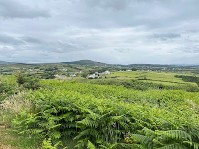
After we had hiked for over 3 hours and taken a lunch break, our guide asked how we were feeling and if we wanted to hike up to an overlook of the bay. I was pretty tired, but we decided to go anyway. It was a great view! She pointed out various geographic and historic points, mentioning that the British Navy once sheltered here in WWI (or WWII?) There were gun installations along both coasts of the bay.
It was so weird walking on the bog lands. It was like walking on a giant sponge. Soft and springy under your feet with a squish-squish of water with each step. It had been dry for several weeks before we came, so it was not nearly as wet as usual. The water in the distance is Lough Swilly (not really a lake, but a fjord opening onto the North Atlantic)
We hiked back down to our car and our guide offered to take us over to the Fort at Dunree point. It was just a "wee hike" to the top, but a good view. (My legs were definitely flagging at this point)
This is looking back at the overlook peak we hiked in the distance (center)
The view overlooking a nearby beach.
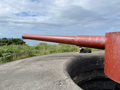
An old gun installation from the fort.
To wrap up the day, we had a bit of a traffic delay - ha!










No comments:
Post a Comment