This was our day on the water and it was so relaxing. Definitely my favorite.

This is Ballycastle harbor. The ferry to Rathlin Island is waiting for us to board. It was pretty small, room for just 5-6 cars/lorries and maybe 100 people max. The harbor faces NE and doesn't have a lot of shelter beyond the manmade rock jetties you can see. A lot of sailing vessels at the piers. There was a small dredging boat that was scraping the bottom off the end of one of the jetties. It never dumped its scoop that we could see, so I think it was just scrapping and dragging stuff further out into the bay. The cliffs in the distance were stunning. The photo doesn't quite capture it at this distance. I think they are called the grand canyon of Ireland. I picked up a geocache overlooking the harbor and then we boarded the ferry.

Cool sculpture of schooling fish at the harbor.


Rathlin Island is L shaped with the harbor in the crook of the L.

There are 3 lighthouses on the island. This was one was white, black, white striped and we couldn't see the light pattern at all. There are more than 40 shipwrecks in the waters around the island, including the HMS Drake which was sunk by a U-boat in 1917. There are divers that dive on these wrecks.

These were some cliffs near the Rathlin harbor as we approached. It looked like someone had taken a knife and sliced part of the hills straight off.

We were told there were often dolphins, but we didn't see any on the trip over or back.

Rathlin Harbor

Looking back across toward Ballycastle

A total of 140 people live on the island. Probably most around the harbor, but we saw houses spread along the 4 mile stretch of road that we rode to the bird sanctuary

It was mostly a grey day, but the flowers were still beautiful and eye-catching.
We followed the crowd off the ferry and to a waiting shuttle bus that takes people 4 miles along the cliffs to the West lighthouse. It was cash-only with no ATM in sight. Thankfully the guy agreed to take euros because we didn't have any pounds!

We arrived at the top of a cliff overlooking bird nesting rocks in both directions. We estimate the cliffs were about 300-400 feet above the ocean.
We were warned upon arrival that there are 98 steps down to the viewing platform (and we would have to climb these upon our return too!) After hiking through the bogs for hours, this was not a problem - ha! Not only is there a lighthouse, its also a bird sanctuary. The colony is one of the largest in Europe. Every spring and summer, thousands of seabirds nest here for hatching babies. Then they head back out to sea.

This is the fog horn with the top of the "upside down" lighthouse below. It was known as the "bull of the west" and could be heard 20 miles away. It was esablished in 1925 and decommissioned in 1995 (due to improved navigational aids). Before the fog horn was installed, keepers would fire cannon instead.

It was quite a feat to build the lighthouse on a cliff. It is made of reinforced concrete which was pretty new when it was built in 1912. Approximately 7 million kilograms of concrete was used and ALL of it was mixed by hand! A site on the sea front was chosen for a jetty. Small boats would ferry equipment to shore from larger ships and a mini inclined railroad was built to transport the construction equipment up the cliff. It was powered by a single horse.

The upper part of the cliff was stabilized and then the lighthouse itself was built. The optimal placement for the light is at 62 meters above the sea to be seen by ships over the earths curvature and below the fog levels.

This is a photo of the lighthouse. (We did not scale the cliffs to capture this angle.)

They nest from April to July. There are many species, but the largest in the colony is the Guillemots. There were also Puffins - penguin like birds that can fly and 'swim'. Because of their weight, they have to flap their wings 400x/minute! They can dive up to 60m (150+ feet). They have red feet and beaks and are pretty easy to spot through the binoculars. They like to nest in the turf surfaces in burrows. They feed their babies, called pufflings, sand eels and after about a month, they lead them out to sea.
The Razorbills can dive 120m (300+ feet) and Guillemots can go 180m down.

(This was taken by Scott through his binoculars!)

This shows the scale of a Guillemot egg to a chicken egg. During the famines in the 1800s, locals would scale the cliffs to collect bird eggs to eat. They tried to collect them early in the season so the birds would produce a second egg and it wouldn't harm the populations.
The lighthouse is automated now. The last light keeper to work here was in 1983. The keepers were highly respected and were often more literate than the rest of the population. They had to keep over 20 different kinds of logs, some of them noted every hour. People in the village would ask them for help with reading and writing letters.

The optic lens for the light floats on a bed of liquid mercury and requires very little energy for rotation. The light here is red every 5 seconds. Each lighthouse has a different pattern/color for identification.

The daisies along the cliff face were so pretty.

I appreciated the pride flags at the welcome center. This bus bumped us along the (almost) single lane road to/from the harbor.

I liked this pond that was at the top of the cliff near the lighthouse. You can see water near you (pond) and in the distance below (ocean).

We picnicked near the seal rocks and saw a few of them floating out in the water. They seemed to be saying 'get off our beach'.

There were multiple momma ducks with a bunch of ducklings. They were feeding and it was so funny to watch a line of 4 ducklings paddle along behind mom and then -woop- down they dive and -boop - pop back up again a minute later.


There was a little bit of sand on the beach, but it was mostly varied color rounded rocks.

We took the ferry back to Ballycastle and wrapped up the day finding a second geocache down in the rocks near the beach.

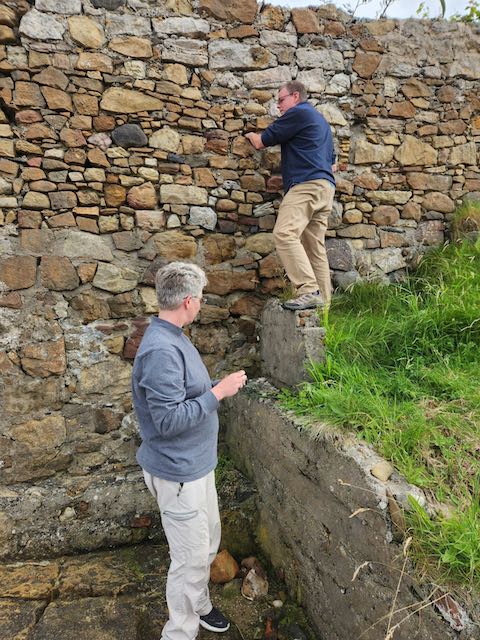

It was very rocky in this spot. The tide was out and we could see a lot of seaweed growing all over the exposed rocks. We passed a ruined building on Rathlin that was labeled as a kelp building. They had over 80 of these over the island back in the day. They would collect and cook down the kelp in kilns and then export it. The high levels of iodine and soda in it would be used for soap making and glass making.
Although our trip to Rathlin today was delightful, the evening ended in a modified disaster. I realized the day we left the US that I had accidentally booked our AirBnb in Belfast for 2 days when we only needed it one. I realized the day we were driving to Belfast that I cancelled the wrong night and we had no lodging for the evening. I tried very hard to reach the property owner and see if we could still come that night. It was listed as available on the app and we had the arrival info, so we decided to go for it. About 30 mins after we arrive and unloaded, started cooking dinner, and started a load of laundry, the owner called me and was a little panicked. He had another guest on the way who would be there in 30 mins. David reloaded our suitcases, Charlene and I finished making dinner, and Scott went around the corner to a hotel to see if we could find somewhere to stay. The hotel only had one room, but the manager had a rental property available. We ate a quick dinner and cleaned up the kitchen and managed to get out before the other guests arrived. I'm sure they thought it was weird that the place smelled like pesto. We drove through the small town along the water front and got to our new place. Very nice.


One double bed, one bunk, and one single. I got the single.

After the frustrating end to the day, Charlene and I walked along the small harbor in the rain for a bit.

No comments:
Post a Comment