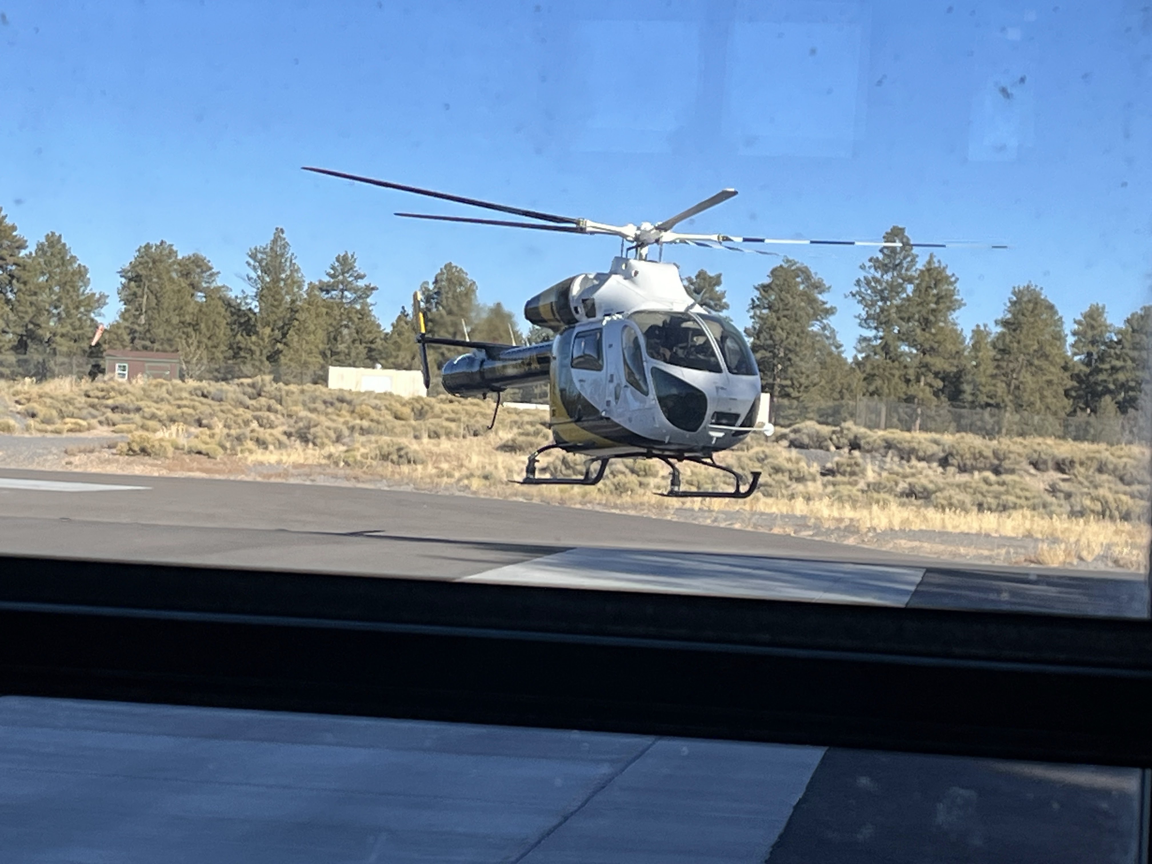
Today we had the opportunity to learn from the aviation division and the fire fighting division at the Grand Canyon. We went over to the helipad on the South Rim, and visited with the chief pilot for an hour. He spoke for about 15 minutes then opened it up for questions. The students asked a lot of curious questions and he did a great job answering them. They have 3 helicopters stationed here and room for several more on the tarmac. I don't know what models they were, but they were not large/heavy lift helicopters. They could carry 600-1500 lbs depending on how much fuel they had and how hot the weather is. He spoke a lot about the different trainings the pilots take to do lifts, etc. The canyon is tricky to fly into because of the winds that flow through it (He likened it to the river flowing down the canyon and hitting boulders causing rapids). They also have a Cessna 206 in service. The pilots who apply here must have at least 1500 hrs, 100 hrs in their type plane, and 50 hrs annually. They also had to have served on the fire line (it was not clear to me in what capacity, but I think on ground crew). Its a pretty competitive environment to work in. I don't think anyone asked how many pilots they have, but I think they have 3 or 4 full time. The aviators log about 650 total hours annually, which is a lot when most of the helicopter flights are .1-.3 hrs. They don't fly at night at all. Many of their missions are wildlife observation in the winter during the quieter months. They provide a lot of support ops carrying supplies and workers into the canyon. On the day we visited, there was a chlorine leak at the water pumping/filter station in the canyon and they were flying in parts and a repair crew. The airspace over the canyon is highly controlled with only the Park Service being able to fly into the canyon itself. Commercial/tourist flights must stay in restricted zones and drones are completely prohibited.

We got to watch this helicopter take off and return about 20 minutes later. In the two hours we spent there, 2 different copters flew 3 different missions and I've started noticing them when I hear them in the distance from the center where we are staying. Its an active job.
They fly some fire suppression missions, but not that many.
After visiting the aviation chief, we stepped next door to talk with the fire chief. I was expecting there to be a big fire crew, but there were only 3 full time people. Their equipment is mostly to keep the buildings in the South Village safe. They have just two trucks (not big ones). They respond to wildfires, but mostly just to keep an eye on them, not to put them out. Much of their work is to engage in forest management and keep trees in the most populated parts of the park pruned (no low branches where ground fire could spread into the boughs), and keep the forest thinned out. At one time the density was 30-40 trees per acre, but due to historic park practice of not allowing fires to burn, the density is now 300-400 trees per acre.

They had a lot of chain saws in their equipment racks! It was really interesting to hear how they had come to work at Grand Canyon. Each had started somewhere else and eventually come here. It was clear that they had a real passion for the work and found being on the fire line to be exciting. Given the recent LA fires and the terror that invokes for me, I can't imagine wanting to do this kind of dangerous work.

One of the people that spoke to us was Jason Nez from the Navaho people. He was one of very few indigenous members of the park service. His job was as a "Fire Archeologist". It took a while for me to figure out what this meant. He is responsible for helping preserve artifacts in wildfire situations (and beyond). He logs tons of time hiking and mapping sites on GIS to know what might be threatened if a fire springs up. Many of the sites are not at risk by the fires themselves (and have been burned many times historically by wildfires), but they can be threatened by fire fighting equipment or by fires that burn too hot because of an excess of dry fuel on the ground. He will literally walk in front of bull dozers that are creating fire lines and fire breaks to make sure they are going around archeological sites. This means he is often very near the front line of fires, so he works very closely with the fire service. He also explained that with not enough nature burns or controlled burns, wood builds up and burns hotter than it might have historically. These hotter fires can cause rocks that are part of archeological sites to explode/shatter, etc. He explained how fires were always part of the ecosystem until the forest service/national park service started suppressing all fires. They used to burn low on the ground and use up dead branches on the ground and dead low branches. They did not consume full trees or get so hot that they were threatening to local communities, now its another story.

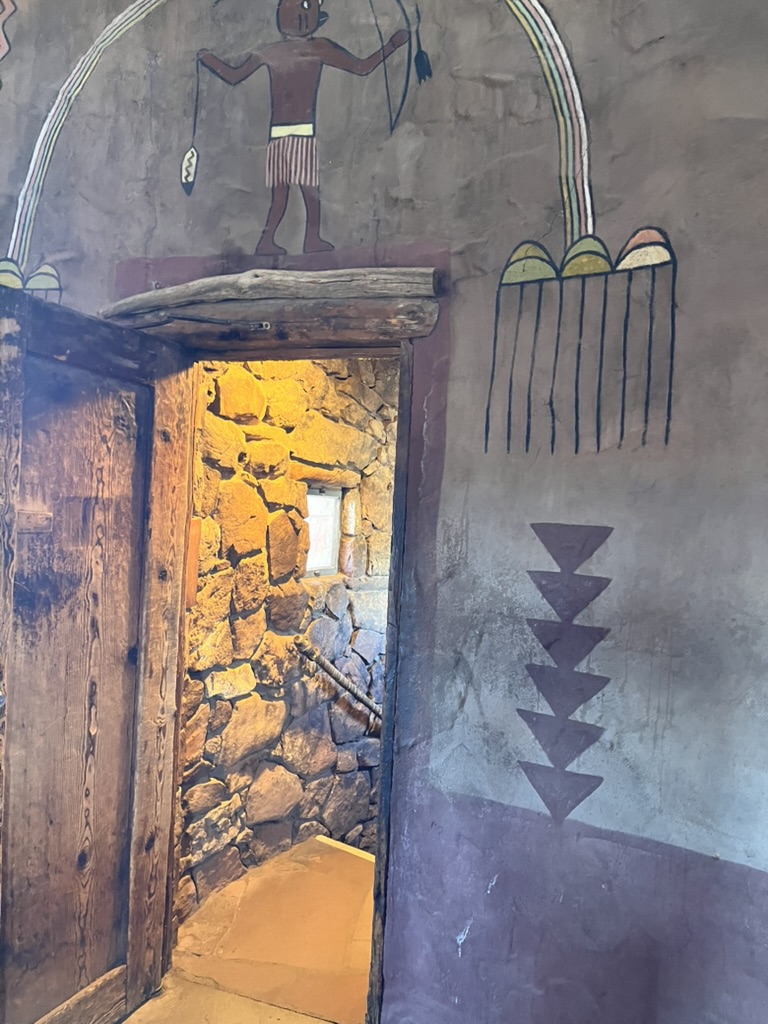
After our learning sessions in the morning, we drove out past Desert View toward the Kaibab National Forest to help Jason clean up a site where illegal logging had taken place. He specifically asked us not to geotag any photos we took because there was an ancestral site at that location and he didn't want people coming out there and doing more damage.
We made quite a sight along the road. I've felt like part of a secret service caravan all week because we have 6 vehicles for the group, plus two from the park service!
We donned some protective gear (thank goodness because I hit my head on low limbs several times). I was also glad I had my hiking boots on because there was a lot of cactus on the ground.
Jason took us into the forest site and started pointing out piles of logs that had been cut and tossed aside in piles. It looked like a very haphazard job, whole trees cut down with a limb removed and the rest laying there; piles of smaller branches tossed into piles under scruby junipers. He explained that our job was to break up all the piles of wood and spread them more evenly around on the floor of the forest so if a fire comes through it will be low and not set all the trees on fire.
One of the fire fighters came with us and had a chain saw to take down the unsightly stumps to the ground.
Before we got started, Jason took us over to the ancient pueblo site, reached down and pulled up this arrow head from the ground and passed it around. He said the site dated to about 1100 AD and they could tell by radiodating the artifacts there.
These pottery shards were also just laying around. Members of our group saw quite a few. Although Jason was not worried about us stepping on them, he wanted to make sure we left them there at the site.
This was the tumbled stone remains of the dwelling and likely an attached storage shelter for crops. This area was once more open and had more rain for corn and other crops to grow. Jason particularly wanted to make sure that no wood was laying on top of the structure in case a fire came through.
We were told to "use our creative imagination" as we spread out the cut limbs. We very happily spread them liberally across the tire tracks where the cutters had come through. They will not find it easy going to drive into this space again (and a temporary camera was set up to possibly catch them if they return).

As with many things we've learned in the canyon, this was not a simple case of illegal cutting. Many of the people on the reservations have substandard housing that gets very cold in the winter. They are no longer allowed to use the natural resources that once belonged to them, so they really need fuel wood to heat their houses. Jason explained that the government is working on a use policy that will allow for sustainable harvesting of wood in the park or national forest. This kind of policy would benefit the forest and the people living near here, it's too bad it will take a lot of time (if it ever happens). At the end of the day Jason said we had probably cleaned up 5 of the 10 acres that had been damaged (that's 5 football fields!).

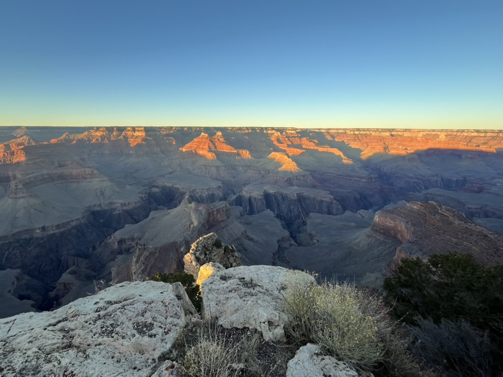
After working in the forest, we had just enough time to drive out to Hermit's rest for a sunset view of the canyon. There are a lot of stops along the way, all with spectacular overlooks, each a little different. This one was a favorite of the group in my vehicle. There is a shear rock face below and directly across.
I liked this clear view of the river more than a mile below us.
Everything gets even more red at sunset, and the green trees along the rim are a great contrast.
The temperature fell about 10 degrees in 30 minutes when the sun went down!
Hermit's Rest opened in 1914. It's an 8 mile ride from El Tovar hotel and the main part of the South Rim sites. People used to ride buggies out and stay in the small lodge overnight before returning to the South Rim. (I didn't get a picture of the lodge).