On Sunday we decided to attend a service in a local church. The Abbaye aux hommes was just down the street from us with services at 9:30 and 11:00. We opted for 9:30 and I'm glad. It was 1 hr 20 mins. The service was in both Latin and French. I was partly able to follow along in the bulletin and caught maybe 20% of the homily. I'd hear words I recognized, but couldn't string them together to catch the message. The acoustics were very live and the echo made it even harder. But the music was beautiful. The service had a lot of chanting that was done in a call and response form. The musical notations in the bulletin looked like they might have in the 1700's with irregular spacing and what looked like handwritten notes on the staff. It was an experience. There were perhaps 100 people in attendance.
Tuesday, October 17, 2023
Abbaye aux Hommes, Trip to the beach, exploration of a WWII bunker complex
Delaney wasn't feeling great (we both caught colds) so we went back to rest for a while before deciding how to spend the afternoon. After a nap, we decided to go for a drive out to the coast near us and walk along the beach.
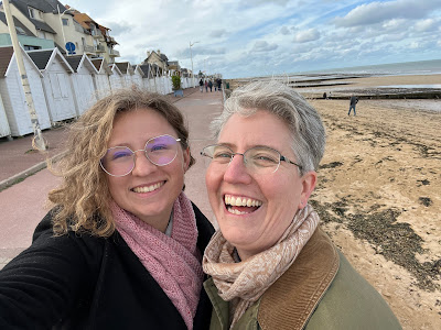
Although it had been warmer when we arrived (80 F), a cold front had passed through at it was about 55-60 F with a strong wind. We knew we wouldn't wade, but it was a pretty day. The guy above though chose to go swimming!
There were a lot of people walking along the board walk and on the beach, and a lot of happy dogs frolicking.
There were beach huts all along the shore with a few people doing end-of-season repairs on them.
This was Sword beach, where the British troops came ashore during D-day and not far from where the Canadians landed.
Delaney and I were instantly drawn up the beach where we could see small sails on the horizon. When we got there, we discovered this shore racers instead of boats. It looked like a lesson going on with youth and a coach.
With the tide out there was a lot of room to 'sail'.
After the beach we pulled up our geocaching app to see if there were any larger caches nearby where we could leave the travel bugs that we brought we with us. Delaney found one that was in the midst of a old WWII command center that had been preserved as a historical site.
This center was on the top of a small hill overlooking the sea (maybe 2 km away). This is a map of all of the trenches as they were in 1944. You can see a black line bisecting the map - this is a village road from the coast that runs inland. The larger dark square on the left along the road is a reinforced vehicle garage with machine gun turret. The other two larger squares in the middle are the two command centers, also with machine gun turrets. The grey circle around the complex was the mine field and there were two full fences of barbed wire around the hill top.
This is a little bit larger map of the area. The place we were (Hillman) is along the bottom. Directly above this complex was another smaller one (closer to the shore). There were connected by telephone (?) cable so they could talk to each other.
View of the ocean from the hill top.
Left over tank.
Treads still in place.
We found our geocache and left a travel bug. Unfortnately the ones that were supposed to be in the cache were missing.
The first building we came across was the well. It contained a pump and drew water from 30 m down. You can see how deep the reinforced building went before reaching the pump. It supplied the full complex which sometimes had over 50 people in it.
This was the water storage tank (Delaney gives you the scale). It was connected by pipe to the pump. It was completed filled in with dirt/rubble until 2002 when it was rediscovered and cleared. Water was used for drinking, cooking, washing, toilets, and for making the tons of concrete used to create this fortification.
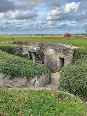
Command Post A. 6 officers were permanently on duty here. It has it own generator, ventilation system, and defenses. On the day this location was captured by a Suffolk regiment, 70 German soldiers were holed up here and surrendered.
I took these photos so anyone reading can have a little interactive experience too :)
Inside the machine gun turret, someone had re-painted the skyline with local buildings and distances. I think there are more trees in the area now than there were then.
You can just see the ocean in the distance.
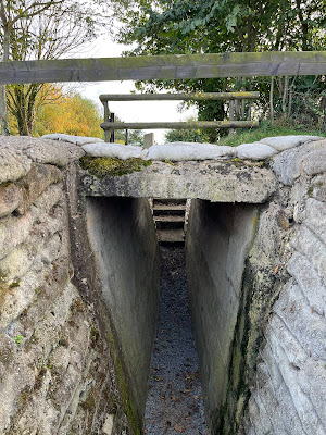
There was only one way for vehicles to drive onto the site without caving in the trench system. This is a small reinforced bridge over one of the trenches where supplies could come in.
This is the cookhouse and dining area.
Kitchen area
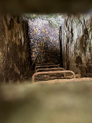
Emergency escape hatch
This is the bridge over the trench for deliveries. The local road is to the right.
The garage
Subscribe to:
Post Comments (Atom)


No comments:
Post a Comment